


28516 - NORTHSIDE Voting District, Troup County, Georgia
About
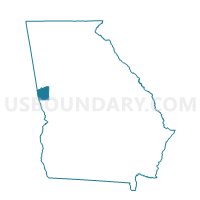
Outline

Summary
| Unique Area Identifier | 562996 |
| Name | 28516 - NORTHSIDE Voting District |
| County | Troup County |
| State | Georgia |
| Area (square miles) | 6.83 |
| Land Area (square miles) | 5.51 |
| Water Area (square miles) | 1.32 |
| % of Land Area | 80.69 |
| % of Water Area | 19.31 |
| Latitude of the Internal Point | 33.09087520 |
| Longtitude of the Internal Point | -85.08066780 |
Maps


Graphs
Select a template below for downloading or customizing gragh for 28516 - NORTHSIDE Voting District, Troup County, Georgia


Neighbors
Neighoring Voting District (by Name) Neighboring Voting District on the Map
- 28501 - HOLLIS HAND Voting District, Troup County, GA
- 28503 - HAMMETT RD Voting District, Troup County, GA
- 28507 - EAST VERNON Voting District, Troup County, GA
- 28510 - MCLENDON Voting District, Troup County, GA
Top 10 Neighboring County Subdivision (by Population) Neighboring County Subdivision on the Map
- LaGrange CCD, Troup County, GA (47,489)
- Hillcrest CCD, Troup County, GA (3,094)
- Abbottsford CCD, Troup County, GA (2,208)
Top 10 Neighboring Place (by Population) Neighboring Place on the Map
Top 10 Neighboring Unified School District (by Population) Neighboring Unified School District on the Map
Top 10 Neighboring State Legislative District Lower Chamber (by Population) Neighboring State Legislative District Lower Chamber on the Map
Top 10 Neighboring State Legislative District Upper Chamber (by Population) Neighboring State Legislative District Upper Chamber on the Map
Top 10 Neighboring 111th Congressional District (by Population) Neighboring 111th Congressional District on the Map
Top 10 Neighboring Census Tract (by Population) Neighboring Census Tract on the Map
- Census Tract 9604, Troup County, GA (6,771)
- Census Tract 9605.01, Troup County, GA (4,412)
- Census Tract 9603, Troup County, GA (4,397)
- Census Tract 9602.01, Troup County, GA (3,094)
- Census Tract 9602.02, Troup County, GA (2,208)